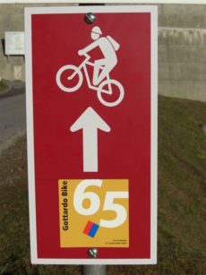
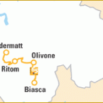
The Rifugio Lago Ritom is accessible from the Leventina Valley departing from Airolo/Piotta/Quinto, from the Blenio Valley via the Passo dell’Uomo, from St. Gotthard via Alpe Pontino, Canaria Valley and Bocchetta del Camoghe’. From our place you can also reach Biasca (Canton Ticino) or Disentis (Canton Graubünden). Both trails are recommended only for trained people. The national trail nr. 65 called Gottardo Bike goes from Andermatt until Biasca/Bellinzona/Locarno or Lugano.
The Gottardo-Bike route combines impressive, high-Alpine landscapes with a detailed lesson in Swiss history. The Gotthardpass has for centuries been one of the most important north-south links and also achieved military significance in World War II. The area is laced with subterranean bunkers, planned to offer refuge in an emergency. Extensive stretches of the route were originally military access roads.
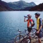
The contrast to the Piora plain further south could not be greater. Here the focus is on nature. The peaceful plain with its two mountain lakes nestles in a rugged high-Alpine landscape. The Lago di Cadagno is actually world-famous among scientists, because there is no seasonal mixing of surface water, unique in Europe.
The descent into Val Blenio mainly follows the old route of the Lukmanier road. In medieval times the Passo del Lucomagno was the most important north-south link until the development of the Gotthard region. Largely unknown, it is one of the most scenic Alpine passes in Switzerland. The route to Olivone leads through open larch groves, over lush green plains, through dense pine forests and counts as one of the most beautiful tours in north Ticino.
| ANDERMATT – LAGO RITOM 45 km (1560 Hm) Mainly on the old pass road and old mule paths up to the legendary Gotthardpass. From the bleak high-mountain landscape on through the Valle Leventina, a thrilling downhill run through forests and ancient hamlets to the traffic hub of Airolo. The trail continues on the “Strada Alta” road until Altanca village and than uphill to Lake Ritom. |
|
LAGO RITOM – OLIVONE 30 km (500 Hm) Impressive pass from Valle Leventina into Val Blenio. The lovely Piora plain with its mountain lakes nestles in a rugged landscape, the descent to Olivone is marked by larch woods, lush green plains and dense pine forests. |
|
OLIVONE – BIASCA 25 km (220 Hm) This last stage explores the Val Blenio, one of the most beautiful valleys in the northern Ticino, and is technically easy, mostly on old country roads. Always with views sweeping along the impressive valley slopes. |
Requirements Technique and Condition: medium-high
Tips Snow until late June on the top of Passo dell’Uomo 2218m.
Panel Follow the sign shown here below
PDF Gottardo_Bike Trail
